weather overcast mostly and humid. 16.7 miles.
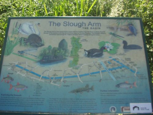
I was aware the grand union canal had a second side arm joining the Thames and how to see it resulted in planning a circular walk. so i start with my arrival at Paddington station
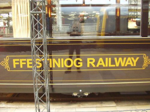
with the surprise of seeing a carriage on the platform from the Ffestiniog railway, i gess advertising their existence, or celebrating some milestone, i know no which but a surprise anyway of a railway i hope to ride again in August.
Now purchase a cuppa and wander of around the corner in search of the Paddington end of the grand union canal, a little sign pointed the way and it was nice and quiet as i headed north to little Venice which soon hove into view, pretty enough as i circled to the far side and start following what is now called the regents canal. This did involve a little of pavement looking down on the canal as the path is gated in places for those who live there.
At one point the canal disappears in a short tunnel but this was no problem just following the road ahead and then find a sign for access back down to the tow path where the tunnel ends.
Yes this could all sound a bit to good as i strolled alongside many barges that are homes, because when i got to the far end of them i came upon a locked gate, ho hum the hikers favorite pass time, back tracking !, well lady luck shone on me once again when only a few yards back i mentioned to a man working on his barge roof the locked gate, no problem as he had a key, so a few minutes chat about the canal and what we were both doing with life saw the gate unlocked and me on my way again.
The canal now runs around Regents park but is in a fairly deep cutting giving an unusual view of some nice architecture in the par, after a while i start to hear rather a lot of bird calls then above me rises a huge netted cage with what look like a selection of Ibis in it (that’s my bird type guessing over for today), of course the map showed i was passing a zoo which explained the situation nicely.
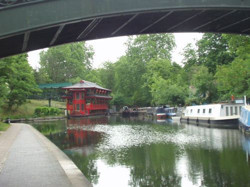
Nearing the end of the park there was a very top heavy looking barge, i guess it’s some kind of floating eatery.
It gets a bit difficult to choose what to photograph as this post could be a lot of photo’s long, but on i go wandering along the path this canal meanders through the Camden area and then down towards St pancras.
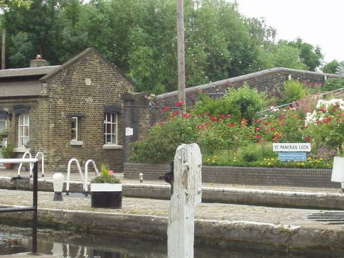
A few times i have ridden out of this large station and looked down on the canal below wondering what it was like, today i was finding out that it is certainly pretty.
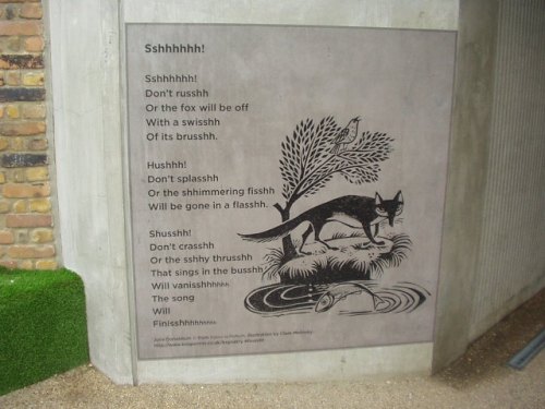
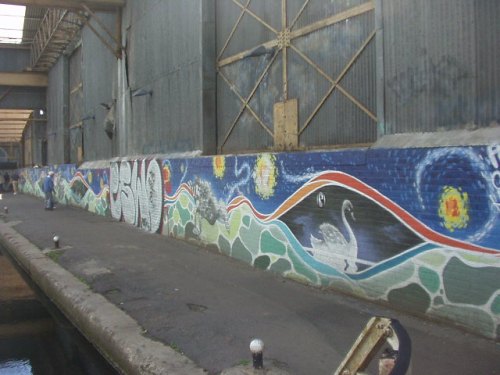
And there was some inspired writing on the wall in some places. (of course there was plenty of graffiti that looked little more than a mess to me).
Moving on towards the Islington area brings a small problem.
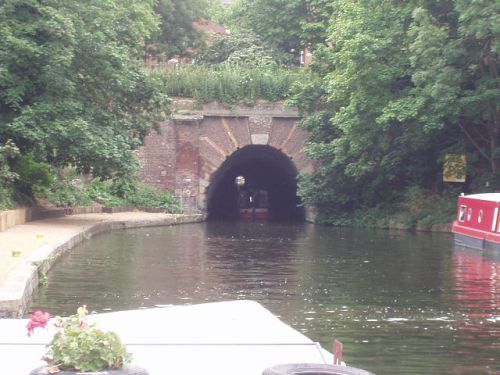
The canal disappears in a tunnel but i could just see light at the end of the tunnel, with no foot path through the tunnel i climbed the steps to street level.
Initially i spotted a sign pointing me in the direction of the eastern end of the tunnel, then the signs disappeared and after a while of guess work i became a little nervous of getting to far north, the biggest problem is old eyes starign at the street map in vain and not wanting to put my pack down to fish out some spectacles i did the other option and asked some one who gave excellent directions. So i’m at street level walking through Islington, seems like a good idea to take a snack break as i was feeling the humidity a little. Food and drink enjoyed i continue, find the canal again and down the steps, onto the path and the quiet canal side stroll continues, through some really nice area’s, old locks, buildings, even a tall chimney, some new development happening, bits of parks and wildlife sanctuaries. i passed the junction with the Hartford canal and thought oh another path unwalked, maybe in the future.
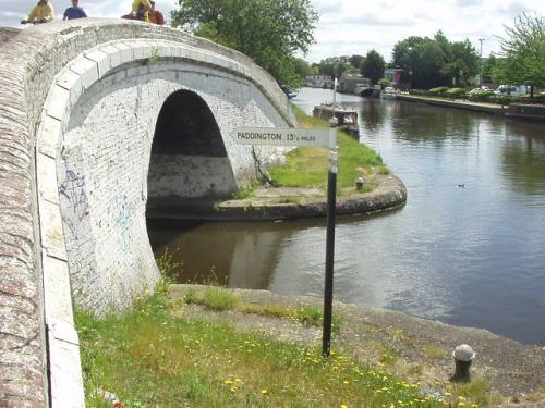
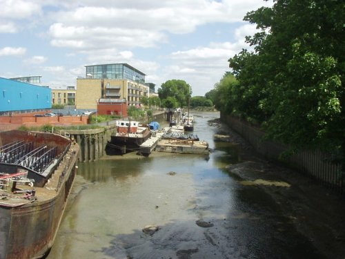
I can only say it was a pleasure all the way to meeting the Thames once again, this time at the Limehouse basin.

And took the this photo back at the last lock into that basin. Now i planned to pick up the Thames path, this time on the north side of the river which was easy enough and i found like when i was on the south side some time ago, it consists of quite a bit of popping to the waters edge where access allows and back amongst high buildings where access is denied. Never mind it’s what we have and i must say initially it was surprisingly quiet. Approaching tower bridge this changed as throngs of tourists were encountered.
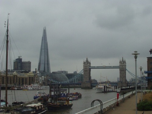
It did give a nice photo opportunity for architecture old and new.
So the theme is places i have not been before, i carry on along the north shore passing many things i have heard of like Cleopatra’s needle, and when i get opposite the London eye, beside big ben i turn right to find St James park. Oh dear, noise abundant, music, loud hailers and banners, yes it’s some sort of protest and i’m walking through the middle of it while noticing the large police presence, none of this was much of a hindrance and provided a nice counter play to reaching the park which was quiet and green with some pleasant wild scents on the breeze. So a walk in the park is all very nice, then it ends at a big round about.
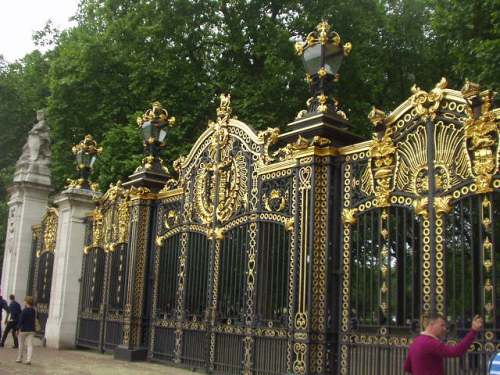
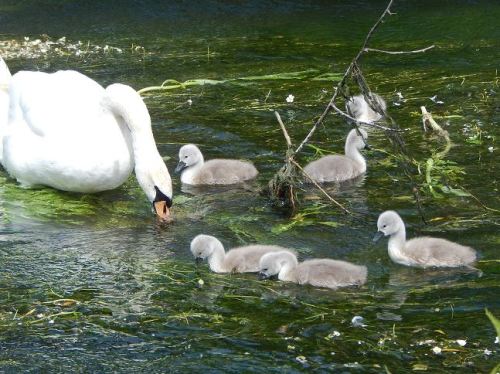
I found myself outside a big house with shiny gates, but seeing no sign for cream tea’s i didn’t stop. No, i carried on up constitution hill and across into Hyde park where there was a tea kiosk, it sure was time for a pack of rest. The walk through this park was along side the serpentine and i’m used to seeing Canada geese in this country but was a little surprised that here they were out numbered by graylag geese and Egyptian geese. At the far end of the serpentine is the end of the park, leaving me with a few streets to navigate before seeing where i started. Was it a good day, well the forecast today was for many showers, i must admit the air did feel damp for a couple of short spells, but it was not easy to notice so basically a dry day.